ORLANDO, Fla. – Last week featured another named storm, the tenth of the season, making landfall in the U.S.
Hurricane Delta became the 10th storm to make landfall in the U.S., breaking the previous record of nine. Delta was also the first Greek letter hurricane to make landfall in the U.S.
Recommended Videos

In the busiest hurricane season on record, we got to Zeta on the Greek alphabet. It appears as we get into next week, we will take more strides at threatening that record.
Closing out October
A weak tropical wave has a small chance to develop near the Lesser Antilles, but atmospheric conditions remain generally hostile and should not be a concern. Another wave east of Bermuda has a chance to develop early next week as it gets pushed toward the Bahamas.
Typically this time of year, the focus is on the Caribbean, as the Cabo Verde season -- storms rolling off of Africa -- slowly comes to a close. The picture below represents all the hurricanes that have developed in the last two weeks of October since 1966.
Map showing where Atlantic named storms have formed over the next two weeks (Oct. 14-27) during the satellite era (since 1966). All major #hurricanes have formed in the central or western Caribbean. pic.twitter.com/xZkBgb4JH7
— Philip Klotzbach (@philklotzbach) October 13, 2020
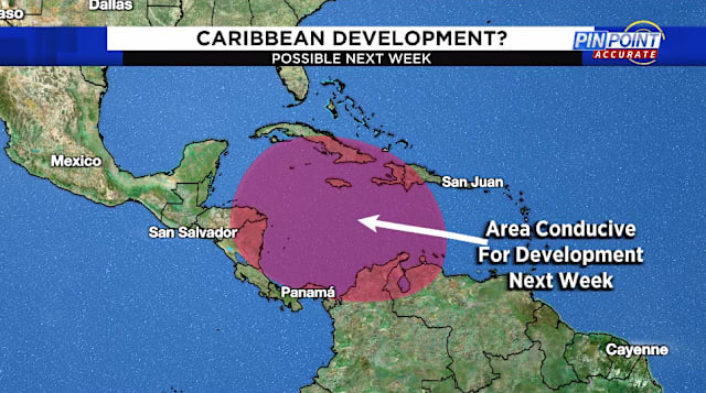
Historically, the strongest systems develop in the Caribbean this time of year. During the next two weeks, that is exactly the region that will be favored for some tropical development.

Large scale atmospheric conditions favor development in the Western Caribbean as we move into next week. It’s too early to tell if Florida would be impacted or not, but anything moving north toward the Gulf of Mexico or Southern Atlantic would need to be watched closely.
Currently, there is not even a disturbance to pinpoint in that region, but given the conditions, thunderstorms appear likely in the Western Caribbean, and could eventually materialize into a tropical system.
Hurricane season runs through Nov. 30.


